
www.aero-defence.tech
12
'26
Written on Modified on
Integrating Deep-Water Echo Sounding Systems for Marine Cartography
The Ocean Exploration Trust and Kongsberg Maritime integrated a high-resolution multibeam echo sounder on the Exploration Vessel Nautilus to enhance deep-ocean digital infrastructure.
www.kongsberg.com
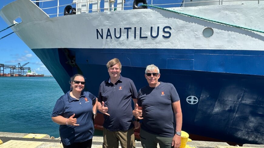
The Ocean Exploration Trust (OET) and Kongsberg Maritime have collaborated to deploy and validate the EM 304 MKII multibeam echo sounder during a 14-day pacific mapping expedition. The operation utilizes the Exploration Vessel (E/V) Nautilus as a real-world testing platform to assess system performance in deep-ocean environments.
Operational Challenges in Deep-Water Surveying
High-resolution cartography of deep ocean environments presents significant logistical and technical challenges. Survey teams must manage access constraints, elevated operational costs, and the technical limitations of traditional acoustic systems when mapping complex underwater topography. High-resolution data acquisition is required across complex bathymetric features, including underwater canyons, seamounts, ridges, trenches, and subsea volcanoes. To address these limitations, industrial automation and advanced sonar systems must operate at full ocean depth while maintaining wide swath coverage and high data resolution.
Technical Solution and System Architecture
The technical solution centers on the Kongsberg EM 304 MKII multibeam echo sounder. This system is engineered to operate at full ocean depth, combining wide-swath acoustic coverage with high spatial resolution.
The division of responsibilities during the deployment is structured to optimize system calibration:
- Ocean Exploration Trust: Provides the E/V Nautilus as the operational vessel, integrates the sonar into its existing sensor suite, and utilizes the data to guide subsequent remotely operated vehicle (ROV) deployments.
- Kongsberg Maritime: Dispatches three embedded engineers for the duration of the 14-day mission to monitor hardware performance, refine software functionality, and analyze live datasets.
The integration was completed as part of a comprehensive vessel upgrade supported by the U.S. Navy’s Office of Naval Research, ensuring compliance with military and scientific digital infrastructure standards.
Field Deployment and Real-World Testing
The system generates live datasets across varied seabed topologies, allowing the embedded engineering team to optimize both hardware transmission parameters and software processing algorithms under actual operational conditions. This environment provides testing parameters that cannot be replicated in laboratory simulations. Additionally, the software interface is evaluated by first-time users within OET’s integrated mapping internship program, providing usability data that informs user-interface refinement.
Target Applications and Operational Impact
The primary application for this technology is deep-sea cartography, which supports environmental monitoring, marine research, and the planning of subsea infrastructure. The operational logic of the EM 304 MKII improves survey efficiency by doubling the geographic area covered per transit unit compared to legacy equipment. This performance increase reduces the time required for spatial surveys and lowers operational costs in remote marine environments. The resulting high-resolution bathymetric maps provide the foundational data required for safe navigation and targeted scientific exploration.
Edited by Evgeny Churilov, Induportals Media - Adapted by AI.
www.kongsberg.com
Field Deployment and Real-World Testing
The system generates live datasets across varied seabed topologies, allowing the embedded engineering team to optimize both hardware transmission parameters and software processing algorithms under actual operational conditions. This environment provides testing parameters that cannot be replicated in laboratory simulations. Additionally, the software interface is evaluated by first-time users within OET’s integrated mapping internship program, providing usability data that informs user-interface refinement.
Target Applications and Operational Impact
The primary application for this technology is deep-sea cartography, which supports environmental monitoring, marine research, and the planning of subsea infrastructure. The operational logic of the EM 304 MKII improves survey efficiency by doubling the geographic area covered per transit unit compared to legacy equipment. This performance increase reduces the time required for spatial surveys and lowers operational costs in remote marine environments. The resulting high-resolution bathymetric maps provide the foundational data required for safe navigation and targeted scientific exploration.
Edited by Evgeny Churilov, Induportals Media - Adapted by AI.
www.kongsberg.com
