
www.aero-defence.tech
17
'26
Written on Modified on
Safran Unveils Land OmniGuard Integrated Counter-Drone System for Mobile Force Protection
Combining optronics, resilient navigation and AI, Safran’s Land OmniGuard enables passive drone detection, tracking and neutralization in contested environments.
www.safran-group.com
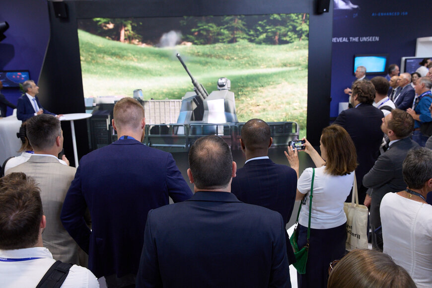
Safran Electronics and Defense has officially launched Land OmniGuard, an integrated mobile solution designed to neutralize low-altitude drone threats in tactical operational environments. The system combines long-range optronics, stabilized sensors, and embedded artificial intelligence onto a single vehicle platform to protect moving forces.
Passive Surveillance Operations within the Automotive Data Ecosystem
The deployment of mobile counter-unmanned aerial system technology requires structural integration within modern military vehicle platforms. This architecture relies on a completely passive operational chain, avoiding radiofrequency emissions that expose vehicle coordinates to adversarial signals intelligence units. By operating without active radar transmission, the system maintains a minimized electronic signature while sustaining constant airspace vigilance on the move.
The underlying detection framework utilizes an advanced panoramic infrared search and track sensor. This thermal imaging module scans the surrounding airspace continuously to capture long-range mid-wave and long-wave infrared signatures. Because the automated mechanism functions independent of active radar reflection, the platform remains highly resilient against anti-radiation loitering munitions and localized electronic warfare measures.
Multi-Sensor Identification and Classification Mechanisms
Once the initial panoramic infrared sensor registers an anomalous thermal signature, the tracking loop transfers the telemetry to a high-definition stabilized optronic sight. This hardware subsystem uses embedded artificial intelligence models to process structural and kinetic data layers. The machine learning algorithms classify the target by extracting geometry, aspect ratios, and velocity parameters to differentiate between recreational quadcopters, military-grade fixed-wing assets, and bird flights.
Following automated classification, the integrated command and control software calculates real-time threat vectors. The system then automatically designates target coordinates to linked active effectors without requiring manual conversion by the crew. This continuous telemetry feed supports rapid handoff to either directional radiofrequency jamming modules or automated kinetic weapon stations, lowering operator cognitive stress during high-density saturating attacks.
Resilient Inertial Navigation in Denied Environments
To coordinate tracking data between mobile vehicles and aerial targets, the platform implements a high-grade hemispherical resonator gyro inertial navigation system. This component provides real-time positional data independent of external radio signals. In tactical theaters where satellite-based positioning navigation and timing data is compromised, this system maintains positioning precision without global navigation satellite system reference points.
Industrial scale manufacturing for this specific inertial sensor core has grown by seven hundred percent between the years 2022 and 2026. This production scaling reflects the increased operational requirement for multi-domain resilience against localized electronic spoofing. A prominent European air defense integrator has finalized the first deployment contract to integrate this integrated tracking suite into an existing land-based defense program.
Additional Context:
This section details technical specifications and competitive benchmarking not included in the original product announcement
The primary architectural benchmark for the passive vehicle system rests on its absolute reliance on electro-optical and infrared telemetry, distinguishing it from conventional active radar tracking systems like the Raytheon Ku-band Radio Frequency Sensor. Active systems provide precise three-dimensional radar cross-section data but consistently reveal the broadcasting vehicle's position across electronic warfare bands.
When compared to existing passive market alternatives, such as the DroneShield DroneSentry platform, the primary engineering difference lies in the integration of high-tier vehicular inertial navigation. While standalone radiofrequency detection sensors and stationary optronic kits experience localized pixel degradation and tracking errors when traveling over uneven terrain at high speed, the integration of the hemispherical resonator gyro counteracts chassis vibration. This mechanical compensation maintains line-of-sight stabilization on small low-altitude targets at extended ranges, maintaining structural tracking fidelity under dynamic cross-country transit conditions.
Edited by Natania Lyngdoh, Induportals editor, assisted by AI.
www.safran-group.com
