
www.aero-defence.tech
09
'26
Written on Modified on
Deepwater Marine Seismic Survey Expands Offshore Brazil Exploration
SLB has partnered with Shearwater GeoServices to acquire high-resolution 3D subsurface data for hydrocarbon exploration in the deepwater Atlantic Margin.
www.slb.com
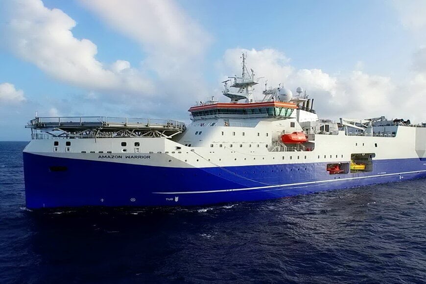
SLB and Shearwater GeoServices have entered into a joint multi-client project to conduct the Amapá 3D marine seismic survey offshore northern Brazil. Targeted at the upstream oil and gas industry, the initiative deploys broadband streamer acquisition combined with inversion processing to evaluate deepwater subsurface geology across Brazil’s Equatorial Margin.
Regional Subsurface Prospectivity in the Equatorial Margin
The Amapá 3D survey encompasses an underexplored sector located roughly 130 kilometers from the Morpho exploratory well, an asset with verified hydrocarbon presence. Frontier exploration in deepwater environments requires high-fidelity seismic data to de-risk drilling targets, characterize complex structural traps, and support upstream operators during regional licensing rounds. According to Andrea Lovatini, vice president of Exploration Data and Geosolutions at SLB, delivering high-resolution imaging reduces technical ambiguity, allowing exploration teams to assess reservoir potential with quantified subsurface constraints.
Broadband Seismic Acquisition and Advanced Inversion Workflows
Data acquisition is assigned to the seismic survey vessel Amazon Warrior using multisensor streamer architecture. This technology samples acoustic wavefields both vertically and horizontally at the streamer location, capturing pressure along with vertical and crossline acceleration. By reconstructing the true seismic wavefield and eliminating marine surface ghost reflections across a broad frequency band, the system resolves fine stratigraphic intervals and steep structural dips that standard single-sensor hydrophone cables obscure.
Following acquisition, SLB applies advanced processing sequences anchored by elastic full-waveform inversion (FWI). Elastic FWI resolves acoustic wave equations to invert multi-component wavefield kinematics and dynamics simultaneously. This mechanism generates detailed velocity and density models of heterogeneous strata, yielding seismic volumes capable of distinguishing fluid variations from lithological changes prior to exploratory drilling.
Additional Context
This section details technical specifications and competitive benchmarking not included in the original product announcement.
Marine multisensor acquisition systems compete primarily on their ability to measure multi-component wavefield gradients and eliminate spectral notches caused by sea-surface reflections. Shearwater’s system uses point-receiver crossline gradient reconstruction to eliminate ghost interference across high and low frequencies, delivering broadband signal response down to low single-digit Hertz.
In commercial deepwater exploration, comparable solutions include multi-component systems such as PGS GeoStreamer and WesternGeco UniQ / marine acquisition equivalents. GeoStreamer relies on dual-sensor hydrophone and vertical geophone pairings, which isolate the upgoing pressure wavefield through wavefield separation principles (P-Z summation). While dual-sensor configurations cancel vertical ghost reflections, multisensor platforms measuring horizontal crossline acceleration provide additional spatial wavefield reconstruction between streamer cables, improving crossline spatial sampling without requiring denser physical cable separation. Furthermore, integrating elastic FWI rather than acoustic-only FWI models secondary shear-wave energy and amplitude-versus-offset (AVO) behavior, providing superior elastic parameter recovery in deepwater salt and clastic systems.
Edited by Evgeny Churilov, Induportals Media - Adapted by AI.
www.slb.com
